Inlet Database: Difference between revisions
Created page with "Under Construction Link to CIRP Website Inlet Database page: *[http://cirp.usace.army.mil/databases/index.html Databases]" |
mNo edit summary |
||
| (51 intermediate revisions by 2 users not shown) | |||
| Line 1: | Line 1: | ||
== Introduction == | |||
[[Image:Google_Ex-US.png|thumb|right|400px|A Google image of inlets locations. Google KMZ file: [[Image:Inlets_071811_kmz.zip]] ]] | |||
The U.S. Army Corps of Engineers' Coastal Inlets Research Program (CIRP) Federal Inlets database consolidates inlet characteristics and statistics in a conveniently accessible web-based form. The Federal Inlets Database contains information compiled for 156 Federally maintained inlets and entrances in the continental United States and Alaska. For the CIRP mission, an inlet or entrance is defined as a maintained channel connecting an ocean or lake to a smaller water body and which experiences long-period water motion by tide or seiching, together with a wave-induced longshore current. Inlet channels contribute to economic vitality as commercial navigational waterways, are part of the military infrastructure of the nation, and are key components of the estuarine ecosystem. The Corps maintains inlet navigability by dredging channels and through implementation and maintenance of controlling structures. Understanding the physical processes occurring at these inlets and entrances is required for predicting the evolution of the inlet and adjacent beaches, both under natural conditions and in response to engineering activities such as routine channel maintenance, channel deepening, and mining of ebb- and flood-tidal shoals. | |||
<br style="clear:both" /> | |||
The Federal Inlets Database presented here is in a developmental stage. A primary goal of the development of the database is to identify information gaps. The collection of additional data is necessary to fully populate the existing database. The Federal Inlets Database must ultimately function as a continually evolving information center to maintain accuracy with the recognition that inlet characteristics change through time. The Federal Inlets Database was organized with the goal of providing information on hydraulic, geomorphic, and geometric parameters for Federally maintained inlets within the continental United States and Alaska. Much of this information is not readily available at this time, and the CIRP is requesting assistance of those possessing additional information to complete the database. | |||
== Location == | |||
[[Image:USACE-Divisions-Map-2007.jpg|thumb|right|450px|Divisions and Districts of the Corps of Engineers, US]] | |||
One motivation for the establishment of the Federal Inlets Database was to obtain information on many inlets over a diverse range of locations. Inlets within the United States have widely differing wave conditions, tidal prisms, magnitudes and directions of longshore sediment transport, structures, and physical geometries (as well as other parameters). The inlets contained within the database are located within 26 states and are maintained under the direction of 20 Corps Districts. The following is a listing of those managing District offices and the corresponding states containing inlets for which they are responsible. | |||
{| border="1" | |||
| • New England (NAE): Maine, New Hampshire, Massachusetts, Rhode Island, Connecticut || • New York (NAN): New York, New Jersey | |||
|- | |||
| • Philadelphia (NAP): New Jersey, Delaware || • Baltimore (NAB): Maryland | |||
|- | |||
| • Norfolk (NAO): Virginia || • Wilmington (SAW): North Carolina | |||
|- | |||
| • Charleston (SAC): South Carolina || • Savannah (SAS): Georgia | |||
|- | |||
| • Jacksonville (SAJ): Florida || • Mobile (SAM): Florida, Alabama | |||
|- | |||
| • New Orleans (MVN): Louisiana || • Galveston (SWG): Texas | |||
|- | |||
| • Los Angeles (SPL): California || • San Francisco (SPN): California | |||
|- | |||
| • Portland (NWP): Oregon, Washington || • Seattle (NWS): Washington | |||
|- | |||
| • Alaska (POA): Alaska || • Hawaii (POH): Hawaii, U.S. Pacific Territories | |||
|- | |||
| • Buffalo (LRB): New York, Ohio || • Detroit (LRE): Michigan, Wisconsin, Minnesota | |||
|} | |||
<br style="clear:both" /> | |||
[[Image:Google_Ex1-NC.png|thumb|right|300px|Example of North Carolina Inlets listed in the Google KMZ.]] | |||
* A Google KMZ file of inlets locations along the US Coast that were investigated in this study. [[Image:Inlets_071811_kmz.zip]] | |||
The inlets contained within the Federal Inlets Database include those with one, two, or no jetties, are located along all coasts of the United States, and are of different sizes. Examples of the inlet conditions and locations include: | |||
<br style="clear:both" /> | |||
{| | |||
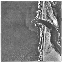
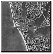
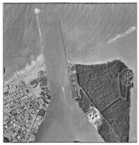
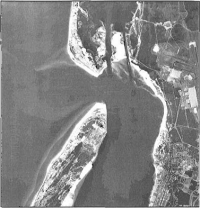
| [[Image:IDB_Fig1.png|thumb|center|200px|Figure 1. Siuslaw River Entrance, OR (large).]] || [[Image:IDB_Fig2.png|thumb|center|220px|Figure 2. Venice Inlet, FL (small).]] ||| [[Image:IDB_Fig3.png|thumb|center|200px|Figure 3. Government Cut, FL (jettied).]] |||| [[Image:IDB_Fig4.png|thumb|center|200px|Figure 4. Pensacola Bay Entrance, FL (no jetty).]] | |||
|- | |||
| [[Image:IDB_Fig5.png|thumb|center|200px|Figure 5. Moriches Inlet, NY (Atlantic).]] || [[Image:IDB_Fig6.png|thumb|center|210px|Figure 6. San Francisco Bay, CA (Pacific).]] ||| [[Image:IDB_Fig7.png|thumb|left|200px|Figure 7. Colorado River mouth, TX (Gulf Coast).]] | |||
|} | |||
'''Data Verification''' | |||
The data presented in the Federal Inlets Database was developed from sources within nineteen Corps Districts, from university and consulting industry reports, and from individuals conducting research at various tidal inlets throughout the study region. | |||
Values presented in the database are representative. Many of the parameters reported, such as tidal prism, are not constant and vary over different time scales and in response to engineering activities such as dredging and dredge and fill. These values must be taken as estimates for the inlets. | |||
[[IDB_Parameters_&_Statistics | Sources of Parameters & Statistics]] | |||
<!-- | |||
-------- | |||
Link to CIRP Website Inlet Database page: | Link to CIRP Website Inlet Database page: | ||
*[http://cirp.usace.army.mil/databases/index.html Databases] | *[http://cirp.usace.army.mil/databases/index.html CIRP Website - Inlets Databases] | ||
Link to Databases from CIRP Website: | |||
*[http://cirp.usace.army.mil/databases/inletsdb/inletsdbinfo.html Database of Federal Inlets and Entrances] | |||
*[http://cirp.usace.army.mil/databases/structdb/structdbinfo.html Database of Inlet Navigation Projects and Structures] | |||
Note: These Databases were last updated in 2000, and are currently being updated. 9 Jul 2011 | |||
--> | |||
== Inlet Database Products == | |||
*[[Inlet_Geomorphic_Analyses | Inlet Geomorphic Analyses]] | |||
*[[Inlet_Geomorph_Bibliography | Inlet & Coastal Geomorphology Annotated Bibliography]] | |||
Back to [[Inlets | Inlets Geospatial Databases]] | |||
Latest revision as of 19:00, 16 November 2018
Introduction
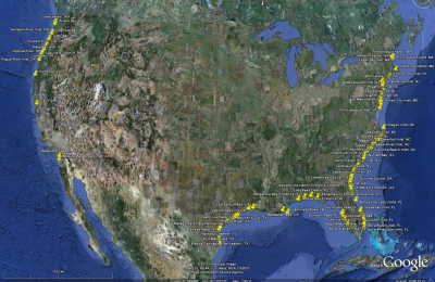
The U.S. Army Corps of Engineers' Coastal Inlets Research Program (CIRP) Federal Inlets database consolidates inlet characteristics and statistics in a conveniently accessible web-based form. The Federal Inlets Database contains information compiled for 156 Federally maintained inlets and entrances in the continental United States and Alaska. For the CIRP mission, an inlet or entrance is defined as a maintained channel connecting an ocean or lake to a smaller water body and which experiences long-period water motion by tide or seiching, together with a wave-induced longshore current. Inlet channels contribute to economic vitality as commercial navigational waterways, are part of the military infrastructure of the nation, and are key components of the estuarine ecosystem. The Corps maintains inlet navigability by dredging channels and through implementation and maintenance of controlling structures. Understanding the physical processes occurring at these inlets and entrances is required for predicting the evolution of the inlet and adjacent beaches, both under natural conditions and in response to engineering activities such as routine channel maintenance, channel deepening, and mining of ebb- and flood-tidal shoals.
The Federal Inlets Database presented here is in a developmental stage. A primary goal of the development of the database is to identify information gaps. The collection of additional data is necessary to fully populate the existing database. The Federal Inlets Database must ultimately function as a continually evolving information center to maintain accuracy with the recognition that inlet characteristics change through time. The Federal Inlets Database was organized with the goal of providing information on hydraulic, geomorphic, and geometric parameters for Federally maintained inlets within the continental United States and Alaska. Much of this information is not readily available at this time, and the CIRP is requesting assistance of those possessing additional information to complete the database.
Location
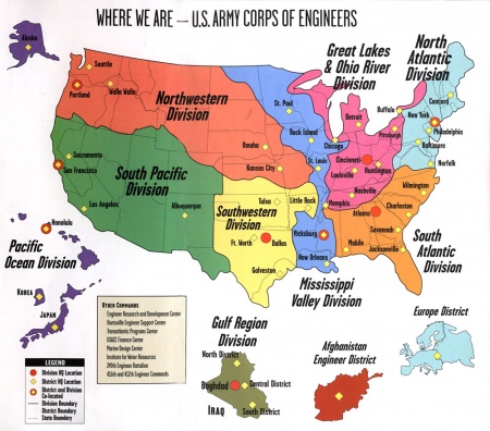
One motivation for the establishment of the Federal Inlets Database was to obtain information on many inlets over a diverse range of locations. Inlets within the United States have widely differing wave conditions, tidal prisms, magnitudes and directions of longshore sediment transport, structures, and physical geometries (as well as other parameters). The inlets contained within the database are located within 26 states and are maintained under the direction of 20 Corps Districts. The following is a listing of those managing District offices and the corresponding states containing inlets for which they are responsible.
| • New England (NAE): Maine, New Hampshire, Massachusetts, Rhode Island, Connecticut | • New York (NAN): New York, New Jersey |
| • Philadelphia (NAP): New Jersey, Delaware | • Baltimore (NAB): Maryland |
| • Norfolk (NAO): Virginia | • Wilmington (SAW): North Carolina |
| • Charleston (SAC): South Carolina | • Savannah (SAS): Georgia |
| • Jacksonville (SAJ): Florida | • Mobile (SAM): Florida, Alabama |
| • New Orleans (MVN): Louisiana | • Galveston (SWG): Texas |
| • Los Angeles (SPL): California | • San Francisco (SPN): California |
| • Portland (NWP): Oregon, Washington | • Seattle (NWS): Washington |
| • Alaska (POA): Alaska | • Hawaii (POH): Hawaii, U.S. Pacific Territories |
| • Buffalo (LRB): New York, Ohio | • Detroit (LRE): Michigan, Wisconsin, Minnesota |
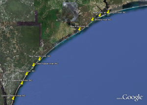
- A Google KMZ file of inlets locations along the US Coast that were investigated in this study. File:Inlets 071811 kmz.zip
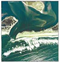
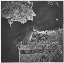
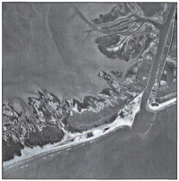
The inlets contained within the Federal Inlets Database include those with one, two, or no jetties, are located along all coasts of the United States, and are of different sizes. Examples of the inlet conditions and locations include:
Data Verification
The data presented in the Federal Inlets Database was developed from sources within nineteen Corps Districts, from university and consulting industry reports, and from individuals conducting research at various tidal inlets throughout the study region.
Values presented in the database are representative. Many of the parameters reported, such as tidal prism, are not constant and vary over different time scales and in response to engineering activities such as dredging and dredge and fill. These values must be taken as estimates for the inlets.
Sources of Parameters & Statistics
Inlet Database Products
Back to Inlets Geospatial Databases
