Importing Bathymetric Datasets: Difference between revisions
No edit summary |
|||
| (9 intermediate revisions by the same user not shown) | |||
| Line 1: | Line 1: | ||
{{TOC right}} | |||
'''Multiple Bathymetric Datasets''' | = '''Multiple Bathymetric Datasets''' = | ||
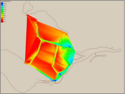
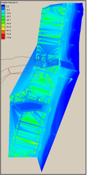
Limited bay bathymetry | Limited bay bathymetry | ||
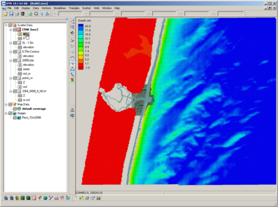
* NOAA – Offshore datasets | * NOAA – Offshore datasets | ||
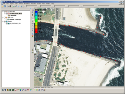
* LIDAR – Shoreline and nearshore (important for structure resolution) | * LIDAR – Shoreline and nearshore (important for structure resolution) | ||
* Channel | * Channel | ||
| Line 19: | Line 16: | ||
[[Image:NewOrleansDataset 1.png|400px]] | [[Image:NewOrleansDataset 1.png|400px]] | ||
[[Image:NewOrleansDataset 2.png|200px]] | [[Image:NewOrleansDataset 2.png|200px]] | ||
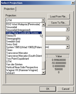
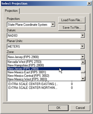
= '''Common Spatial Reference Datum & Vertical Datum''' = | |||
[[Image:NewOrleansDataset 3.png|350px]] | |||
'''Common Spatial Reference Datum & Vertical Datum''' | |||
[[Image:NewOrleansDataset 52.png|350px]] | [[Image:NewOrleansDataset 52.png|350px]] | ||
[[Image:NewOrleansDataset 53.png|350px]] | [[Image:NewOrleansDataset 53.png|350px]] | ||
[[Image:NewOrleansDataset 4.png|350px]] | [[Image:NewOrleansDataset 4.png|350px]] | ||
= '''Tides and Currents (NOAA)''' = | |||
https://tidesandcurrents.noaa.gov/ | |||
[[Image:NewOrleansDataset 5.png|350px]] | [[Image:NewOrleansDataset 5.png|350px]] | ||
| Line 48: | Line 36: | ||
[[Image:NewOrleansDataset 7.png|400px]] | [[Image:NewOrleansDataset 7.png|400px]] | ||
= '''Vertical Datum Conversions''' = | |||
'''Vertical Datum Conversions''' | |||
[[Image:NewOrleansDataset 54.png|400px]] | [[Image:NewOrleansDataset 54.png|400px]] | ||
| Line 57: | Line 43: | ||
[[Image:NewOrleansDataset 8.png|400px]] | [[Image:NewOrleansDataset 8.png|400px]] | ||
'''Prep for the Coastal Modeling System''' | = '''Prep for the Coastal Modeling System''' = | ||
* Based off of a Cartesian grid | * Based off of a Cartesian grid | ||
| Line 71: | Line 56: | ||
* Shark River Inlet bathymetry will be converted to State Plane horizontal coordinates in meters with the vertical datum set to MSL in meters | * Shark River Inlet bathymetry will be converted to State Plane horizontal coordinates in meters with the vertical datum set to MSL in meters | ||
'''Reprojecting Coordinates and Changing Datums''' | = '''Reprojecting Coordinates and Changing Datums''' = | ||
[[Image:NewOrleansDataset 9.png|400px]] | [[Image:NewOrleansDataset 9.png|400px]] | ||
| Line 79: | Line 63: | ||
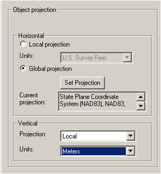
Object Projection tells SMS what the coordinates are to be project in. This can modify the location that SMS will display the dataset. Checking “Specify” Project Projection is how coordinates are converted to a different projection and vertical datum. | Object Projection tells SMS what the coordinates are to be project in. This can modify the location that SMS will display the dataset. Checking “Specify” Project Projection is how coordinates are converted to a different projection and vertical datum. | ||
'''Converting Elevations to Depths (CMS Requirement)''' | = '''Converting Elevations to Depths (CMS Requirement)''' = | ||
[[Image:NewOrleansDataset 10.png|400px]] | [[Image:NewOrleansDataset 10.png|400px]] | ||
| Line 91: | Line 74: | ||
Select Depths Elevations Flips negative elevations to positive depths. Necessary for CMS model calculation. | Select Depths Elevations Flips negative elevations to positive depths. Necessary for CMS model calculation. | ||
'''NAN Channel Surveys''' | = '''NAN Channel Surveys''' = | ||
[[Image:NewOrleansDataset 12.png|400px]] | [[Image:NewOrleansDataset 12.png|400px]] | ||
| Line 103: | Line 85: | ||
MLW (ft) – COE Datum (not local NOAA benchmark) | MLW (ft) – COE Datum (not local NOAA benchmark) | ||
'''Conversions''' | = '''Conversions''' = | ||
[[Image:NewOrleansDataset 8.png|400px]] | [[Image:NewOrleansDataset 8.png|400px]] | ||
'''NAN Channel Surveys Extended in to Bay''' | = '''NAN Channel Surveys Extended in to Bay''' = | ||
[[Image:NewOrleansDataset 13.png|400px]] | [[Image:NewOrleansDataset 13.png|400px]] | ||
[[Image:NewOrleansDataset 15.png|400px]] | [[Image:NewOrleansDataset 15.png|400px]] | ||
[[Image:NewOrleansDataset 54.png|400px]] | [[Image:NewOrleansDataset 54.png|400px]] | ||
| Line 124: | Line 102: | ||
MLW (ft) – COE Datum (not local NOAA benchmark) | MLW (ft) – COE Datum (not local NOAA benchmark) | ||
= '''Dataset Calculator''' = | |||
'''Dataset Calculator''' | |||
[[Image:NewOrleansDataset 16.png|400px]] | [[Image:NewOrleansDataset 16.png|400px]] [[Image:NewOrleansDataset 17.png|400px]] | ||
[[Image:NewOrleansDataset 19.png|400px]] | [[Image:NewOrleansDataset 18.png|400px]] [[Image:NewOrleansDataset 19.png|400px]] | ||
= '''NJ DEP Channel Surveys''' = | |||
'''NJ DEP Channel Surveys''' | |||
[[Image:NewOrleansDataset 20.png|400px]] | [[Image:NewOrleansDataset 20.png|400px]] | ||
| Line 152: | Line 125: | ||
= '''Field Data Collection – Multibeam Bay Bathymetry (August 2009)''' = | |||
'''Field Data Collection – Multibeam Bay Bathymetry (August 2009)''' | |||
| Line 163: | Line 134: | ||
[[Image:NewOrleansDataset 22.png|400px]] | [[Image:NewOrleansDataset 22.png|400px]] | ||
'''LIDAR''' | = '''LIDAR''' = | ||
| Line 179: | Line 149: | ||
NAVD88 (ft) | NAVD88 (ft) | ||
'''Coastal Relief Model (DTM/DEM)''' | = '''Coastal Relief Model (DTM/DEM)''' = | ||
[[Image:NewOrleansDataset 24.png|400px]] | [[Image:NewOrleansDataset 24.png|400px]] | ||
| Line 192: | Line 161: | ||
*Generate a 3 sec (pt/3rd second) grid | *Generate a 3 sec (pt/3rd second) grid | ||
'''Coastal Relief Model''' | = '''Coastal Relief Model''' = | ||
[[Image:NewOrleansDataset 28.png|400px]] | [[Image:NewOrleansDataset 28.png|400px]] | ||
| Line 203: | Line 171: | ||
MSL (m) – Not accurate for shallow bathymetry (used for offshore) | MSL (m) – Not accurate for shallow bathymetry (used for offshore) | ||
'''Extra Bathymetry''' | = '''Extra Bathymetry''' = | ||
[[Image:NewOrleansDataset 29.png|400px]] | [[Image:NewOrleansDataset 29.png|400px]] | ||
| Line 217: | Line 184: | ||
*Added extra bay contour (set to -0.75 m) | *Added extra bay contour (set to -0.75 m) | ||
'''Convert a Shapefile to Map''' | = '''Convert a Shapefile to Map''' = | ||
[[Image:NewOrleansDataset 31.png|400px]] | [[Image:NewOrleansDataset 31.png|400px]] | ||
| Line 232: | Line 198: | ||
*Turn off GIS Data Arcs generated where GIS polylines | *Turn off GIS Data Arcs generated where GIS polylines | ||
= '''Convert a Map to Scatter''' = | |||
'''Convert a Map to Scatter''' | |||
[[Image:NewOrleansDataset 34.png|400px]] | [[Image:NewOrleansDataset 34.png|400px]] | ||
| Line 249: | Line 214: | ||
*Modify as necessary (i.e. remove entrance channel shoreline because it is old seawall and jetty configuration – LIDAR used here) | *Modify as necessary (i.e. remove entrance channel shoreline because it is old seawall and jetty configuration – LIDAR used here) | ||
'''Create a Contour Polyline in the Map Module''' | |||
= '''Create a Contour Polyline in the Map Module''' = | |||
[[Image:NewOrleansDataset 39.png|400px]] | [[Image:NewOrleansDataset 39.png|400px]] | ||
| Line 265: | Line 231: | ||
*Select arcs and convert the z elevation to the desired contour elevation | *Select arcs and convert the z elevation to the desired contour elevation | ||
'''Create Scatterset Points from Map Data''' | = '''Create Scatterset Points from Map Data''' = | ||
[[Image:NewOrleansDataset 42.png|400px]] | [[Image:NewOrleansDataset 42.png|400px]] | ||
| Line 281: | Line 247: | ||
[[Image:NewOrleansDataset 46.png|400px]] | [[Image:NewOrleansDataset 46.png|400px]] | ||
'''All Files Referenced to Same Horizontal and Vertical Datum''' | = '''All Files Referenced to Same Horizontal and Vertical Datum''' = | ||
| Line 292: | Line 257: | ||
*Delete unnecessary data points (check alignment and elevations in overlapping datasets) | *Delete unnecessary data points (check alignment and elevations in overlapping datasets) | ||
'''Merging Scattersets''' | = '''Merging Scattersets''' = | ||
[[Image:NewOrleansDataset 49.png|400px]] | [[Image:NewOrleansDataset 49.png|400px]] | ||
| Line 304: | Line 268: | ||
*Merging all scattersets will integrate all points. Overlapping areas of scattersets should either be deleted, or use a separate method of merging (by prioritizing using triangles). | *Merging all scattersets will integrate all points. Overlapping areas of scattersets should either be deleted, or use a separate method of merging (by prioritizing using triangles). | ||
'''Surface-water Modeling System (SMS)''' | = '''Surface-water Modeling System (SMS)''' = | ||
'''Questions?''' | '''Questions?''' | ||
| Line 312: | Line 275: | ||
Tanya Beck | Tanya Beck | ||
Tanya.m.beck@usace.army.mil | Tanya.m.beck@usace.army.mil | ||
Or | Or | ||
Mitch Brown | Mitch Brown | ||
Mitchell.e.brown@usace.army.mil | Mitchell.e.brown@usace.army.mil | ||
Latest revision as of 19:43, 9 August 2023
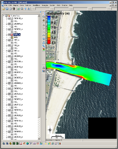
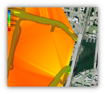
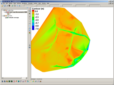
Multiple Bathymetric Datasets
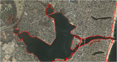
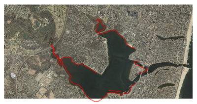
Limited bay bathymetry
- NOAA – Offshore datasets
- LIDAR – Shoreline and nearshore (important for structure resolution)
- Channel
NJ State maintains north channel and north bay channel
Federally maintained entrance and south channel (15 years)
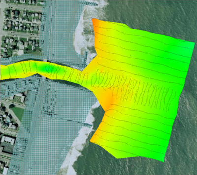
- NAN-supported field data collection
Included bathymetry of the backbay (Spring High Tide)
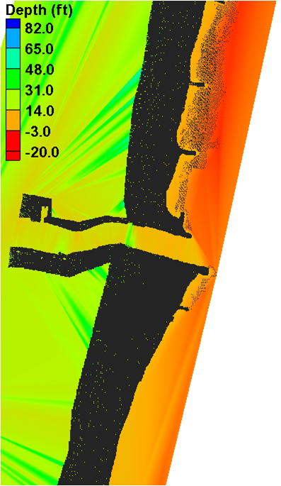
Common Spatial Reference Datum & Vertical Datum
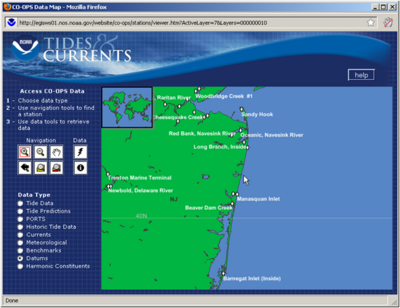
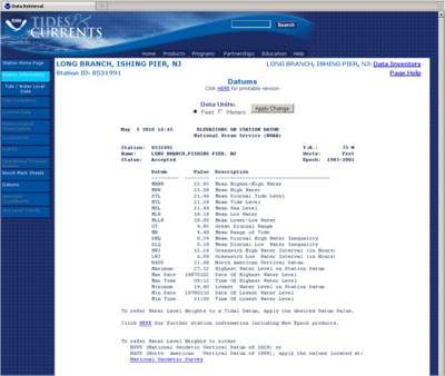
Tides and Currents (NOAA)
https://tidesandcurrents.noaa.gov/
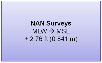
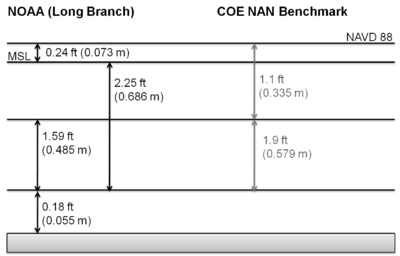
Vertical Datum Conversions
Prep for the Coastal Modeling System
- Based off of a Cartesian grid
- Planar coordinate system
- Model computation is in metric and depths are positive from zero (elevations are flipped)
- Grid is generated based off of a single bathymetry file stored in SMS scatterset file format
- Vertical datum is not specified and is assumed local
- The boundary condition forcing (tidal) must be in the same datum as the bathymetry
- Typically modeling grids are brought to a mean datum such as mean sea level (msl) or mean tide level (mtl)
- This requires that all datasets are brought in to unified projection, datum, and units
- Shark River Inlet bathymetry will be converted to State Plane horizontal coordinates in meters with the vertical datum set to MSL in meters
Reprojecting Coordinates and Changing Datums
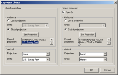
Object Projection tells SMS what the coordinates are to be project in. This can modify the location that SMS will display the dataset. Checking “Specify” Project Projection is how coordinates are converted to a different projection and vertical datum.
Converting Elevations to Depths (CMS Requirement)
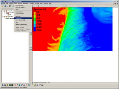
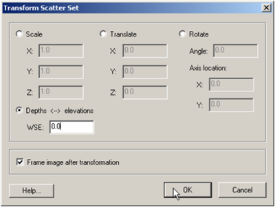
Data Transform Can adjust scatterset data by scaling, translating (adding/subtracting), or rotating horizontal or veritcal
Select Depths Elevations Flips negative elevations to positive depths. Necessary for CMS model calculation.
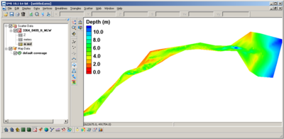
NAN Channel Surveys
- Horizontal Datum:
State Plane NAD27 New Jersey 2900 (ft)
- Vertical Datum:
MLW (ft) – COE Datum (not local NOAA benchmark)
Conversions
NAN Channel Surveys Extended in to Bay
- Horizontal Datum:
State Plane NAD27 New Jersey 2900 (ft)
- Vertical Datum:
MLW (ft) – COE Datum (not local NOAA benchmark)
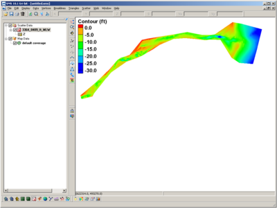
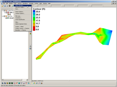
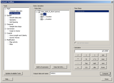
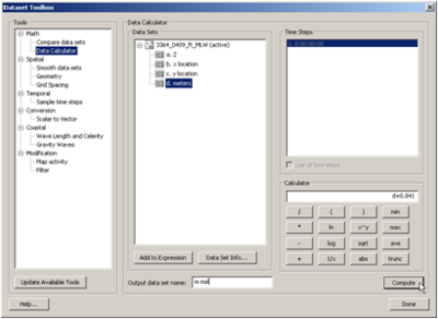
Dataset Calculator
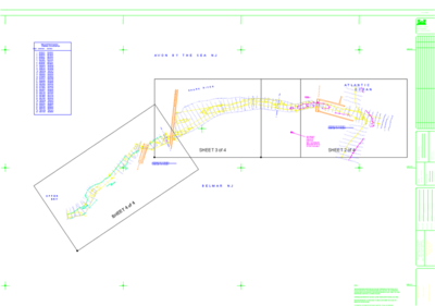
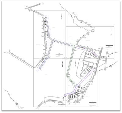
NJ DEP Channel Surveys
- XYZ pulled out of drawing and changed to ascii format
Provided conversion from local datum to NAVD88: MLW à NAVD88 + 2.41 ft (0.735 m) MLW à MSL + 2.17 ft (0.661 m)
Field Data Collection – Multibeam Bay Bathymetry (August 2009)
Horizontal Datum: State Plane NAD83 New Jersey 2900 (m) Vertical Datum: NAVD88 (m)
LIDAR
- Files are emailed in separate sections from the NOAA CSC Archive
- Typically several to 10s of files that are 5 - 100 mb in size
- Compiling takes time
- Points have been sampled/filtered and cropped to area of interest
- Horizontal Datum:
State Plane NAD83 New Jersey 2900 (ft) Vertical Datum: NAVD88 (ft)
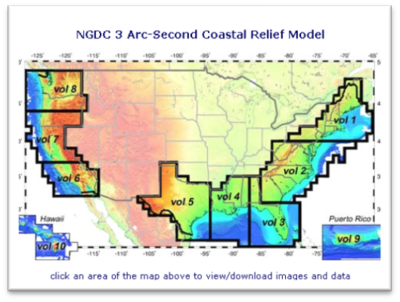
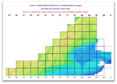
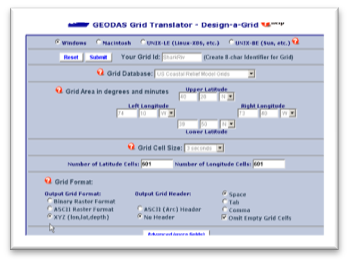
Coastal Relief Model (DTM/DEM)
- Generate a 3 sec (pt/3rd second) grid
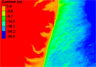
Coastal Relief Model
- Horizontal Datum:
Geographic NAD83
- Vertical Datum:
MSL (m) – Not accurate for shallow bathymetry (used for offshore)
Extra Bathymetry
- Convert shoreline shapefile in SMS
- Horizontal Datum:
State Plane NAD83 New Jersey 2900 (ft)
- Added extra bay contour (set to -0.75 m)
Convert a Shapefile to Map
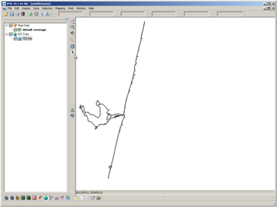
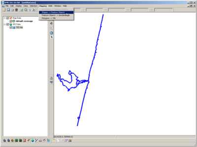
- Drag and drop the shapefile (.shp)
- Highlight all Coastline Mapping – Shapes and Feature Objects
- Turn off GIS Data Arcs generated where GIS polylines
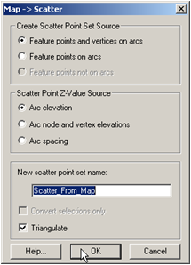
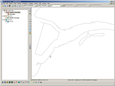
Convert a Map to Scatter
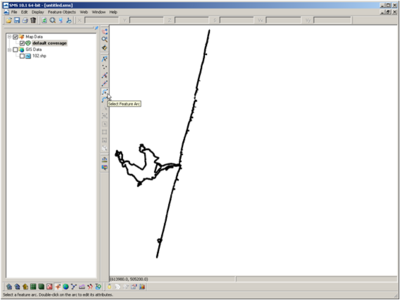
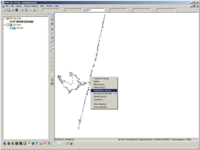
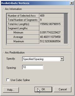
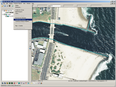
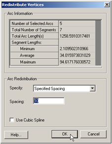
- Highlight all Arcs, Rt-Click Redistribute Vertices Specified Spacing (spacing in spatial coordinates)
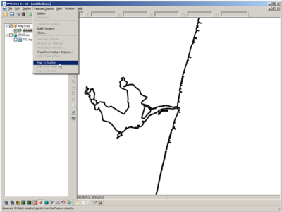
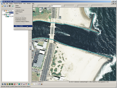
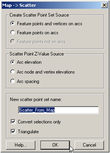
- Feature Objects Map à Scatter Include all feature points and vertices (vertices spacing was set to 10)
- Modify as necessary (i.e. remove entrance channel shoreline because it is old seawall and jetty configuration – LIDAR used here)
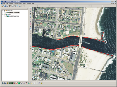
Create a Contour Polyline in the Map Module
Select Default Coverage under Map Data
- Type à Generic à Mapping/Observation/Shoals
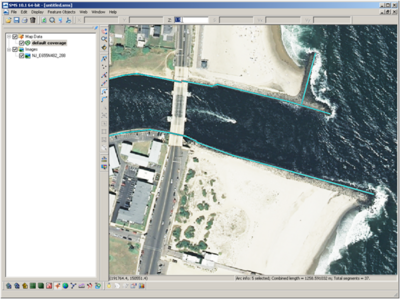
- Draw arcs (polylines) feature with tool
- Select arcs and convert the z elevation to the desired contour elevation
Create Scatterset Points from Map Data
- Select arcs to redistribute the spacing of vertices Feature Objects à Redistribute Vertices Specify Spacing based on horizontal coordinate system units (metric in this case)
- Feature Objects à Map>Scatter Include Feature Pts and vertices and the Arc Elevations
All Files Referenced to Same Horizontal and Vertical Datum
- Delete unnecessary data points (check alignment and elevations in overlapping datasets)
Merging Scattersets
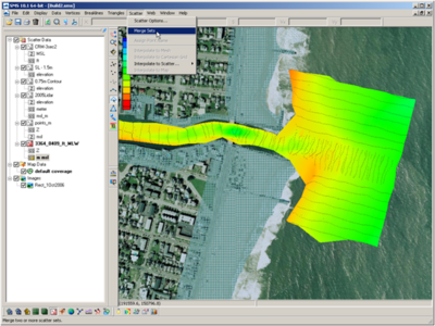
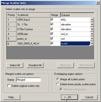
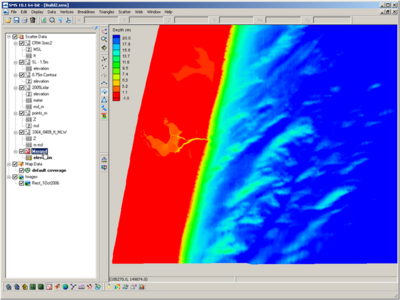
- Merging all scattersets will integrate all points. Overlapping areas of scattersets should either be deleted, or use a separate method of merging (by prioritizing using triangles).
Surface-water Modeling System (SMS)
Questions?
Tanya Beck Tanya.m.beck@usace.army.mil
Or
Mitch Brown Mitchell.e.brown@usace.army.mil
