File:QR DEMOverview.jpg: Difference between revisions
Jump to navigation
Jump to search
No edit summary |
(No difference)
|
Latest revision as of 19:39, 9 December 2024
The 2018 (a) and 2019 (b) Homer, AK DEM coverage includes over 35 kilometers of shoreline from Diamond Creek east to the Homer Spit. Highest elevation values are depicted as yellow colors whereas lowest elevations are in blue colors.
File history
Click on a date/time to view the file as it appeared at that time.
| Date/Time | Thumbnail | Dimensions | User | Comment | |
|---|---|---|---|---|---|
| current | 19:39, 9 December 2024 | 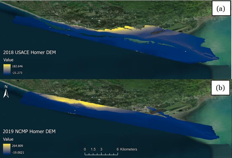 | 806 × 547 (55 KB) | Rdchlaje (talk | contribs) |
You cannot overwrite this file.
File usage
The following page uses this file: