Importing Bathymetric Datasets: Difference between revisions
No edit summary |
No edit summary |
||
| Line 4: | Line 4: | ||
Limited bay bathymetry | Limited bay bathymetry | ||
NOAA – Offshore datasets | * NOAA – Offshore datasets | ||
LIDAR – Shoreline and nearshore (important for structure resolution) | * LIDAR – Shoreline and nearshore (important for structure resolution) | ||
Channel | * Channel | ||
NJ State maintains north channel and north bay channel | NJ State maintains north channel and north bay channel | ||
| Line 14: | Line 14: | ||
Federally maintained entrance and south channel (15 years) | Federally maintained entrance and south channel (15 years) | ||
NAN-supported field data collection | * NAN-supported field data collection | ||
Included bathymetry of the backbay (Spring High Tide) | Included bathymetry of the backbay (Spring High Tide) | ||
| Line 21: | Line 21: | ||
[[Image:NewOrleansDataset 2.png|200px]] | [[Image:NewOrleansDataset 2.png|200px]] | ||
'''Common Spatial Reference Datum & Vertical Datum''' | '''Common Spatial Reference Datum & Vertical Datum''' | ||
[[Image:NewOrleansDataset 52.png|350px]] | |||
[[Image:NewOrleansDataset 53.png|350px]] | |||
[[Image:NewOrleansDataset 3.png|350px]] | [[Image:NewOrleansDataset 3.png|350px]] | ||
[[Image:NewOrleansDataset 4.png|350px]] | [[Image:NewOrleansDataset 4.png|350px]] | ||
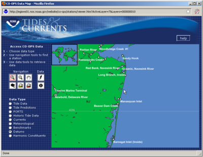
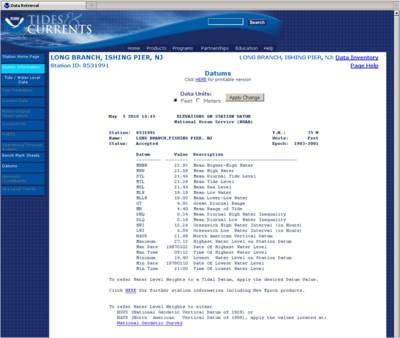
'''Tides and Currents (NOAA)''' | |||
http://tidesandcurrents.noaa.gov/station_retrieve.shtml?type=Datums | |||
[[Image:NewOrleansDataset 5.png|350px]] | [[Image:NewOrleansDataset 5.png|350px]] | ||
[[Image:NewOrleansDataset 6.png|400px]] | [[Image:NewOrleansDataset 6.png|400px]] | ||
[[Image:NewOrleansDataset 7.png|400px]] | [[Image:NewOrleansDataset 7.png|400px]] | ||
'''Vertical Datum Conversions''' | |||
[[Image:NewOrleansDataset 54.png|400px]] | |||
[[Image:NewOrleansDataset 8.png|400px]] | [[Image:NewOrleansDataset 8.png|400px]] | ||
'''Prep for the Coastal Modeling System''' | |||
* Based off of a Cartesian grid | |||
* Planar coordinate system | |||
* Model computation is in metric and depths are positive from zero (elevations are flipped) | |||
* Grid is generated based off of a single bathymetry file stored in SMS scatterset file format | |||
* Vertical datum is not specified and is assumed local | |||
* The boundary condition forcing (tidal) must be in the same datum as the bathymetry | |||
* Typically modeling grids are brought to a mean datum such as mean sea level (msl) or mean tide level (mtl) | |||
* This requires that all datasets are brought in to unified projection, datum, and units | |||
* Shark River Inlet bathymetry will be converted to State Plane horizontal coordinates in meters with the vertical datum set to MSL in meters | |||
'''Reprojecting Coordinates and Changing Datums''' | |||
[[Image:NewOrleansDataset 9.png|400px]] | [[Image:NewOrleansDataset 9.png|400px]] | ||
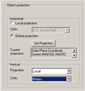
Object Projection tells SMS what the coordinates are to be project in. This can modify the location that SMS will display the dataset. Checking “Specify” Project Projection is how coordinates are converted to a different projection and vertical datum. | |||
'''Converting Elevations to Depths (CMS Requirement)''' | |||
[[Image:NewOrleansDataset 10.png|400px]] | [[Image:NewOrleansDataset 10.png|400px]] | ||
Data Transform Can adjust scatterset data by scaling, translating (adding/subtracting), or rotating horizontal or veritcal | |||
[[Image:NewOrleansDataset 11.png|400px]] | [[Image:NewOrleansDataset 11.png|400px]] | ||
Select Depths Elevations Flips negative elevations to positive depths. Necessary for CMS model calculation. | |||
'''NAN Channel Surveys''' | |||
[[Image:NewOrleansDataset 12.png|400px]] | [[Image:NewOrleansDataset 12.png|400px]] | ||
*Horizontal Datum: | |||
State Plane NAD27 New Jersey 2900 (ft) | |||
*Vertical Datum: | |||
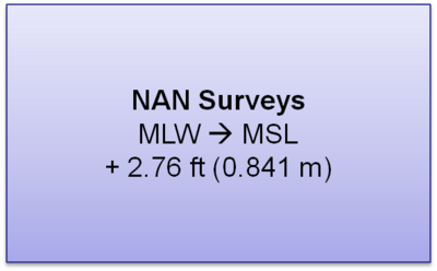
MLW (ft) – COE Datum (not local NOAA benchmark) | |||
'''Conversions''' | |||
[[Image:NewOrleansDataset 8.png|400px]] | |||
[[Image:NewOrleansDataset 13.png|400px]] | [[Image:NewOrleansDataset 13.png|400px]] | ||
[[Image:NewOrleansDataset 14.png|400px]] | [[Image:NewOrleansDataset 14.png|400px]] | ||
Revision as of 19:50, 27 December 2010
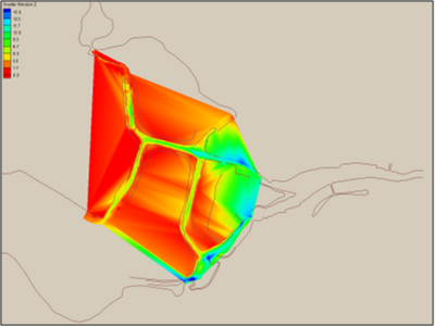
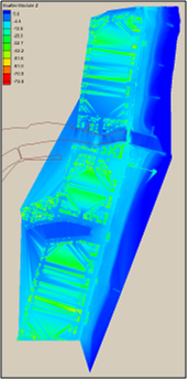
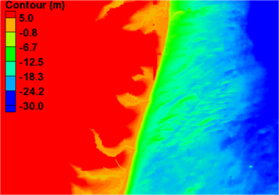
Multiple Bathymetric Datasets
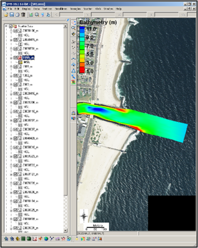
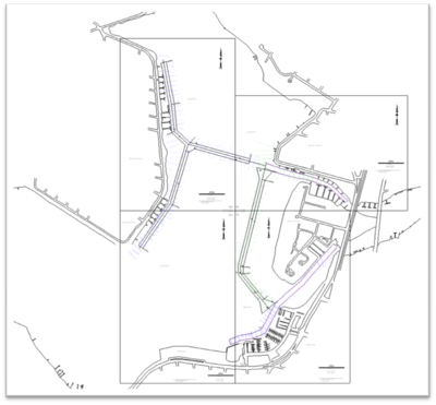
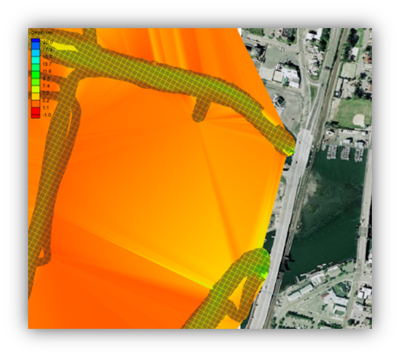
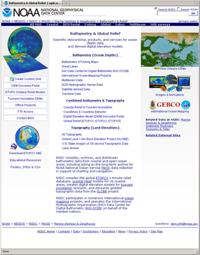
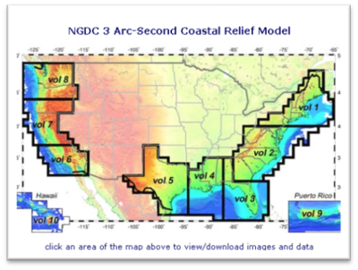
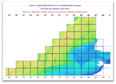
Limited bay bathymetry
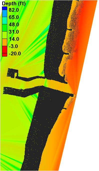
- NOAA – Offshore datasets
- LIDAR – Shoreline and nearshore (important for structure resolution)
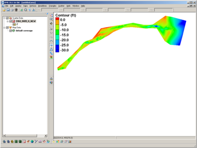
- Channel
NJ State maintains north channel and north bay channel
Federally maintained entrance and south channel (15 years)
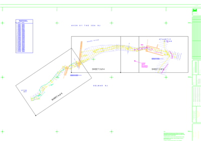
- NAN-supported field data collection
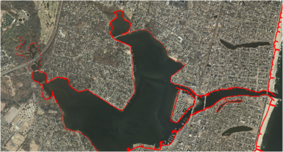
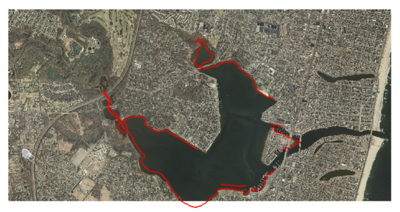
Included bathymetry of the backbay (Spring High Tide)
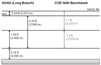
Common Spatial Reference Datum & Vertical Datum
Tides and Currents (NOAA)
http://tidesandcurrents.noaa.gov/station_retrieve.shtml?type=Datums
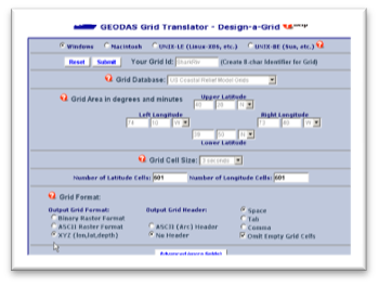
Vertical Datum Conversions
Prep for the Coastal Modeling System
- Based off of a Cartesian grid
- Planar coordinate system
- Model computation is in metric and depths are positive from zero (elevations are flipped)
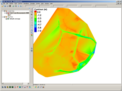
- Grid is generated based off of a single bathymetry file stored in SMS scatterset file format
- Vertical datum is not specified and is assumed local
- The boundary condition forcing (tidal) must be in the same datum as the bathymetry
- Typically modeling grids are brought to a mean datum such as mean sea level (msl) or mean tide level (mtl)
- This requires that all datasets are brought in to unified projection, datum, and units
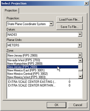
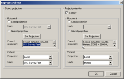
- Shark River Inlet bathymetry will be converted to State Plane horizontal coordinates in meters with the vertical datum set to MSL in meters
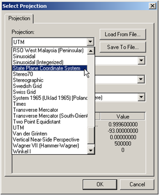
Reprojecting Coordinates and Changing Datums
Object Projection tells SMS what the coordinates are to be project in. This can modify the location that SMS will display the dataset. Checking “Specify” Project Projection is how coordinates are converted to a different projection and vertical datum.
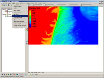
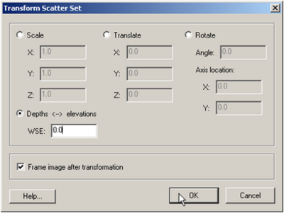
Converting Elevations to Depths (CMS Requirement)
Data Transform Can adjust scatterset data by scaling, translating (adding/subtracting), or rotating horizontal or veritcal
Select Depths Elevations Flips negative elevations to positive depths. Necessary for CMS model calculation.
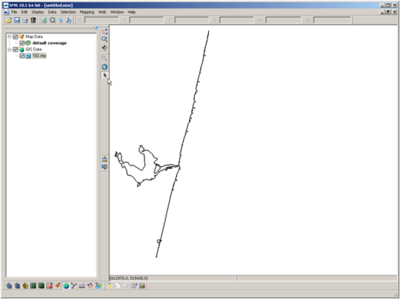
NAN Channel Surveys
- Horizontal Datum:
State Plane NAD27 New Jersey 2900 (ft)
- Vertical Datum:
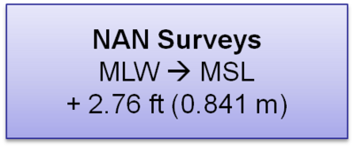
MLW (ft) – COE Datum (not local NOAA benchmark)
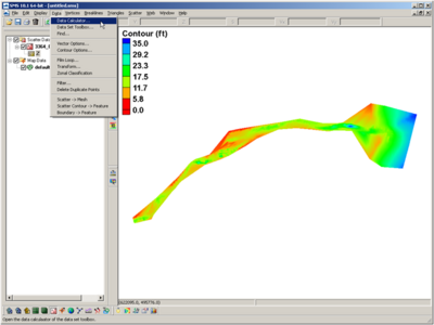
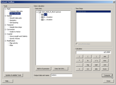
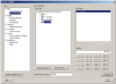
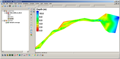
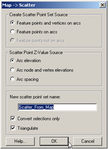
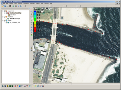
Conversions
