Shark River Inlet: Difference between revisions
Jump to navigation
Jump to search
No edit summary |
No edit summary |
||
| Line 1: | Line 1: | ||
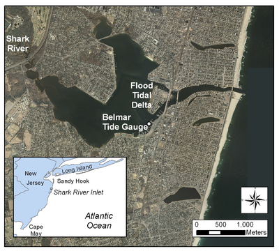
[[Image:Shark_River_Cover.PNG|thumb|right|400px|Shark River Inlet]] | [[Image:Shark_River_Cover.PNG|thumb|right|400px|Shark River Inlet]] | ||
'''Topics:''' | |||
# Introduction | |||
# Importing Bathymetric Datasets and Aerial Photographs | |||
# CMS-Flow Setup | |||
## Grid Generation | |||
## Bathymetry Preconditioning | |||
## Auxiliary Datasets | |||
## Boundary Conditions | |||
## Model Parameters | |||
# CMS-Wave Setup | |||
## Grid Generation | |||
## Model Parameters and Input Spectra | |||
## Providing Sea Buoy Data to CMS-Wave | |||
# Steering | |||
# Viewing Results and Making Animation | |||
# Calculation of Channel Infilling and Transport Rates | |||
<br style="clear:both" /> | <br style="clear:both" /> | ||
Revision as of 15:14, 14 May 2010

Topics:
- Introduction
- Importing Bathymetric Datasets and Aerial Photographs
- CMS-Flow Setup
- Grid Generation
- Bathymetry Preconditioning
- Auxiliary Datasets
- Boundary Conditions
- Model Parameters
- CMS-Wave Setup
- Grid Generation
- Model Parameters and Input Spectra
- Providing Sea Buoy Data to CMS-Wave
- Steering
- Viewing Results and Making Animation
- Calculation of Channel Infilling and Transport Rates