SAJ-Sarasota County: Difference between revisions
No edit summary |
No edit summary |
||
| Line 3: | Line 3: | ||
<font color=red>'''UNDER CONSTRUCTION'''</font> | <font color=red>'''UNDER CONSTRUCTION'''</font> | ||
[[Image:SAJ_BSPNP5.png|thumb|right| | [[Image:SAJ_BSPNP5.png|thumb|right|400px|Figure 1. New Pass and Big Sarasota Pass, Sarasota County, Florida.]] | ||
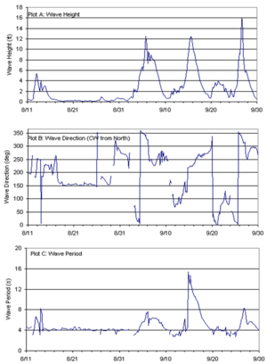
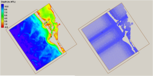
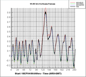
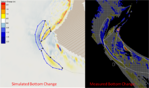
The Jacksonville District (SAJ) was directed to conduct a regional sediment study of a section of the Sarasota County, Florida Gulf Coast shoreline that encompasses New Pass and Big Sarasota Pass and the adjacent beaches to develop an in-depth understanding of wave-forced and tidally-forced sediment transport processes and to configure an analytical model of the two-inlet system that includes regional sediment sources, sinks, and pathways that could be used for evaluating engineering and management alternatives. This effort was funded by the RSM program and | The Jacksonville District (SAJ) was directed to conduct a regional sediment study of a section of the Sarasota County, Florida Gulf Coast shoreline that encompasses New Pass and Big Sarasota Pass and the adjacent beaches (Figure 1) to develop an in-depth understanding of wave-forced and tidally-forced sediment transport processes and to configure an analytical model of the two-inlet system that includes regional sediment sources, sinks, and pathways that could be used for evaluating engineering and management alternatives. This effort was funded by the RSM program and focuses on the CMS-M2D morphological modeling of the Big Sarasota Pass and New Pass inlet system. Qualitative and Quantitative comparisons of CMS-M2D and LIDAR derived bathymetric changes were conducted, for the period of May to November 2004, to demonstrate the ability of CMS-M2D to simulate the morphology of the area. | ||
[[Image:SAJ_BSPNP4.png|thumb|right|300px|Figure 1. New Pass and Big Sarasota Pass, Sarasota County, Florida.]] | |||
[[Image:SAJ_BSPNP1.png|thumb|right|300px|Figure 1. New Pass and Big Sarasota Pass, Sarasota County, Florida.]] | |||
[[Image:SAJ_BSPNP2.png|thumb|right|300px|Figure 1. New Pass and Big Sarasota Pass, Sarasota County, Florida.]] | |||
[[Image:SAJ_BSPNP3.png|thumb|right|300px|Figure 1. New Pass and Big Sarasota Pass, Sarasota County, Florida.]] | |||
Revision as of 19:09, 8 December 2010
UNDER CONSTRUCTION
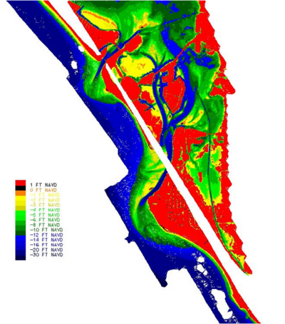
The Jacksonville District (SAJ) was directed to conduct a regional sediment study of a section of the Sarasota County, Florida Gulf Coast shoreline that encompasses New Pass and Big Sarasota Pass and the adjacent beaches (Figure 1) to develop an in-depth understanding of wave-forced and tidally-forced sediment transport processes and to configure an analytical model of the two-inlet system that includes regional sediment sources, sinks, and pathways that could be used for evaluating engineering and management alternatives. This effort was funded by the RSM program and focuses on the CMS-M2D morphological modeling of the Big Sarasota Pass and New Pass inlet system. Qualitative and Quantitative comparisons of CMS-M2D and LIDAR derived bathymetric changes were conducted, for the period of May to November 2004, to demonstrate the ability of CMS-M2D to simulate the morphology of the area.
