User Guide 028
17 Appendix G: Inverse Distance Interpolation
The inverse-distance interpolation also referred to as Shepard interpola-tion is given by (Shepard 1968)
| (17-1) |
where the interpolation weights are given by
| (17-2) |
where
= real and positive power parameter [-]
d = distance between the known points and the unknown interpolation points equal to the Euclidean norm .
In this interpolation, the weight of each point decreases with distance from the interpolated point. One advantage of the inverse-distance interpolation is the interpolation weights are independent of the interpolation function, and therefore only need to be calculated once and can be saved for computational efficiency.
18 Appendix H: Providing Sea Buoy Data to CMS-Wave
Directional spectral data collected by NDBC or CDIP buoys can be pro-cessed as alternative source for wave input to CMS-Wave. Two examples are given below using CDIP 154 and NDBC 44025 standard spectral files for December 2009.
- • NDBC buoy data – run ndbc-spectra.exe (FORTRAN) to read the NDBC standard directional wave file and generate the CMS-Wave input spectral *.eng.
- 1. Download the NDBC standard monthly directional wave spectral file from
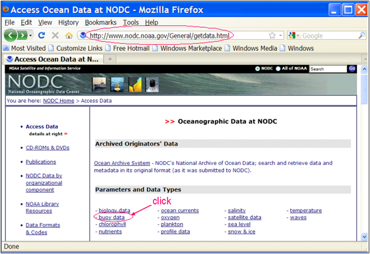
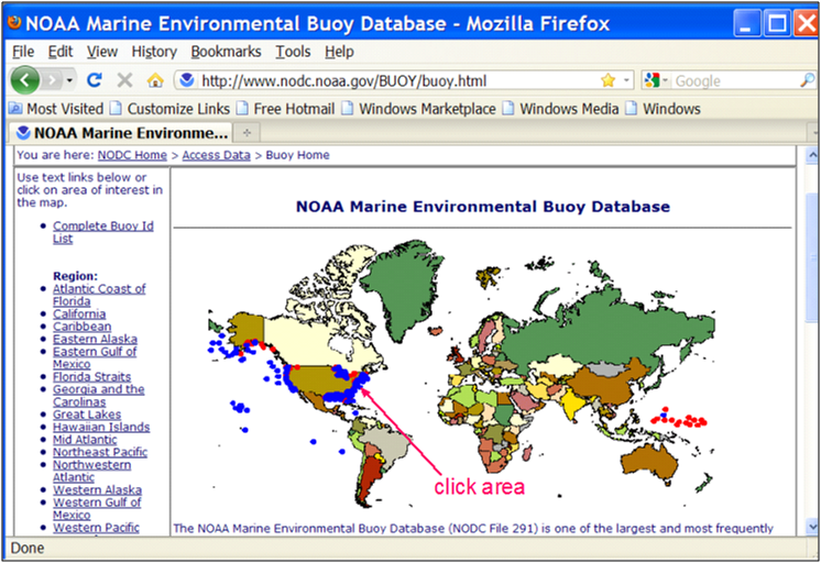
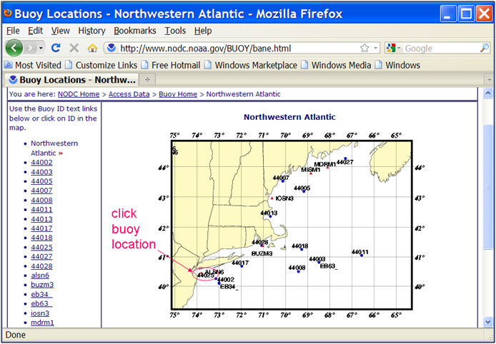
http://www.nodc.noaa.gov/BUOY/buoy.html (e.g., 44025_200912) - see Figs 2.3.1 to 2.3.4 for accessing NDBC spectral data from the Web.
- 2. In the DOS window, run ndbc-spectra.exe
- 3. Responding to the on-screen input, type the NDBC spectral filename
- 4. Type the starting timestamp (default value is 0) for saving output files
- 5. Type ending timestamp (default is 99999999) for saving output files
- 6. Type the time interval (hr) for saving output data
- 7. Type 2 to save the CMS-Wave *.eng and *.txt files
- 8. Type the CMS-Wave input spectrum filename (*.eng)
- 9. Type the local shoreline orientation (the CMS-Wave grid y axis) in clockwise polar coordinates (deg, positive from North covering the sea, e.g., 180 deg for St Mary’s Entrance, FL/GA, or 360 deg - the wave grid orientation angle in *.sim)
- 10. Type the NDBC buoy location water depth (m) and then the CMS-Wave seaward boundary mean water depth (m), e.g. Buoy 44025 has a nominal depth of 36.3 m relative to Mean Sea Level
- 11. Type 1 to include wind or 0 to skip the wind input information
12. Type 1 or 2 or 3 for different choice of calculated frequency bins to complete the run – see Fig 2.3.5 for running ndbc-spectra.exe in DOS.
The output files include *.txt, *.eng, *.out (time series of wave parameters at the buoy), and *.dat (time series of shoreward wave parameters at the CMS-Wave offshore boundary).
Figure G-1. NODC buoy data access website.
Figure G-2. NODC buoy data access world map.
Figure G-3. NODC buoy data access regional map.
figure g-4
figure g-5
• CDIP buoy data - run cdip-spectra.exe (also FORTRAN code) to read the CDIP standard directional wave file and generate the CMS-Wave input *.eng file. Download the CDIP wave file from http://cdip.ucsd.edu/?nav=historic&sub=data (e.g., sp154-200912) – see Figure G- 6 to Figure G- 8.
Run cdip-spectra.exe in the DOS window similar to ndbc-spectra.exe – see Figure G- 9. Because CDIP spectral file already contains the buoy location depth information, cdip-spectra.exe will not prompt for this depth input. For processing either NDBC or CDIP data, users shall check and manually fill any data gaps in *.eng and *.txt files (using the first available spectral data from the neighboring time interval).
figure g-6
figure g-7
figure g-8
figure g-9


