Sargent Beach Lessons Learned: Difference between revisions
(Created page with " == Introduction and Study Overview == [[Image:GenCade1.png|thumb|Fig. 1. Study area map of Point Lookout, Long Beach Island, New York.|250px|Fig. 1. Study area map of Poin...") |
No edit summary |
||
| Line 1: | Line 1: | ||
== Introduction and Study Overview == | == Introduction and Study Overview == | ||
The Port of Bay City, Texas, asked the U.S. Army Corps of Engineers to develop potential structural solutions to reduce erosion of critical beach baitat and to increase protection from tropical storms in Matagorda County. The two primary areas of concern are Sargent Beach and a 2-3 mile stretch of beach on Matagorda Peninsula located about a mile east of the Mouth of the Colorado River (MCR). This two-part study investigated the coastal processes of the region and introducted several structural alternatives to reduce erosion. Phase 1 of the study investigated the coastal processes and determined which structural solutions would be evaluated further in Phase 2. | |||
This study was presented in a series of technical reports. http://cirp.usace.army.mil/Downloads/PDF/CHL-TR-12-11.pdf | |||
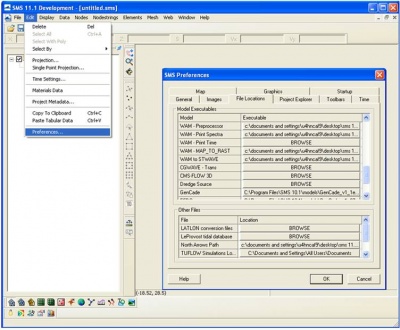
[[Image:fig1_def_Gen.jpg|400px|thumb|left|Figure 1. Define GenCade model executable]] | |||
<br style="clear:both" /> | |||
- | |||
- | |||
[[Image: | |||
Revision as of 16:26, 1 August 2013
Introduction and Study Overview
The Port of Bay City, Texas, asked the U.S. Army Corps of Engineers to develop potential structural solutions to reduce erosion of critical beach baitat and to increase protection from tropical storms in Matagorda County. The two primary areas of concern are Sargent Beach and a 2-3 mile stretch of beach on Matagorda Peninsula located about a mile east of the Mouth of the Colorado River (MCR). This two-part study investigated the coastal processes of the region and introducted several structural alternatives to reduce erosion. Phase 1 of the study investigated the coastal processes and determined which structural solutions would be evaluated further in Phase 2.
This study was presented in a series of technical reports. http://cirp.usace.army.mil/Downloads/PDF/CHL-TR-12-11.pdf
