File:DEM Coverage Golovin AK.png
Jump to navigation
Jump to search

Size of this preview: 498 × 600 pixels. Other resolution: 1,024 × 1,233 pixels.
Original file (1,024 × 1,233 pixels, file size: 2.21 MB, MIME type: image/png)
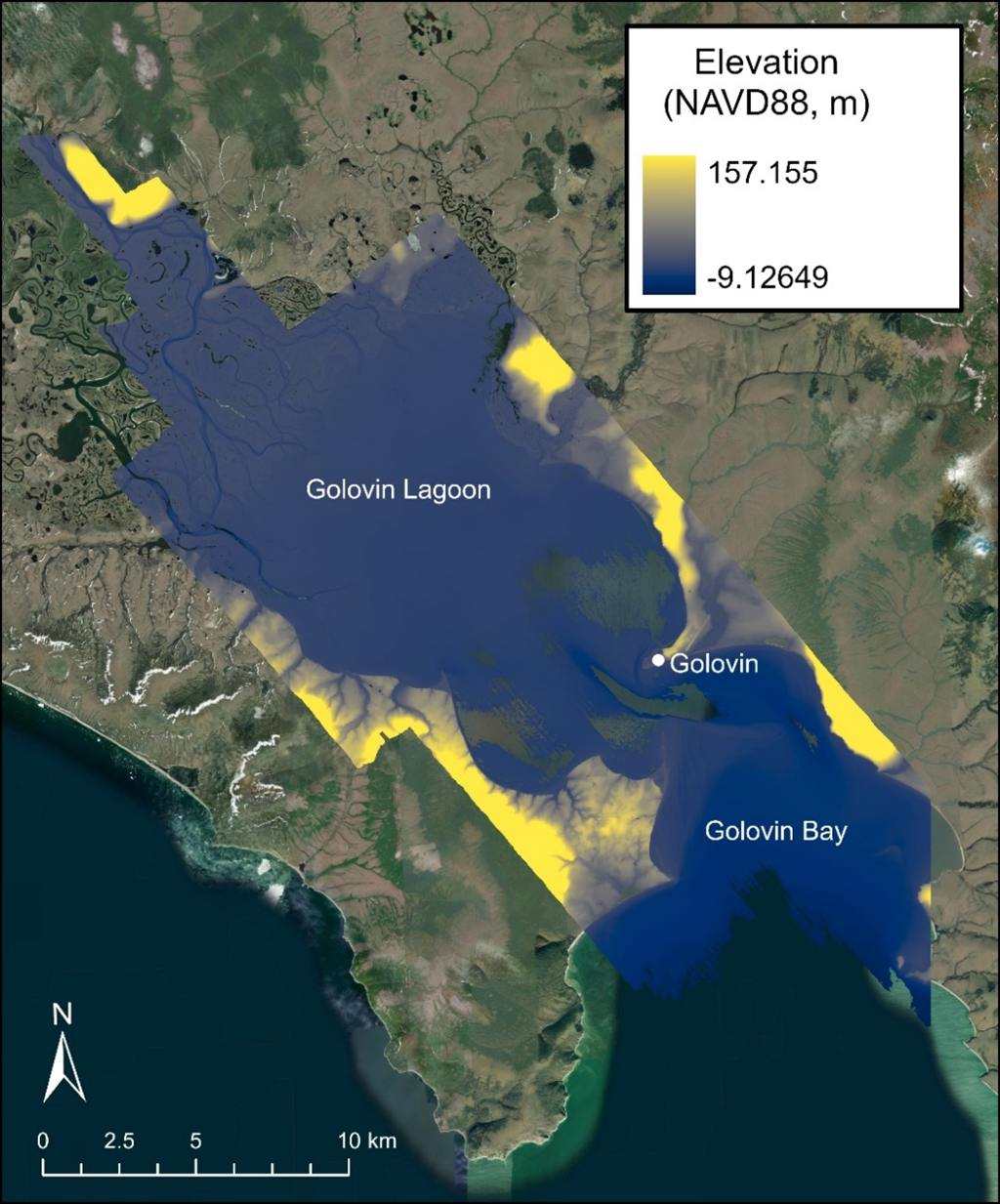
Figure 2. Golovin, AK DEM coverage (colormap) that includes Golovin, Golovin Bay and Golovin Lagoon.
File history
Click on a date/time to view the file as it appeared at that time.
| Date/Time | Thumbnail | Dimensions | User | Comment | |
|---|---|---|---|---|---|
| current | 14:49, 26 September 2024 | | 1,024 × 1,233 (2.21 MB) | RDCHLSLS (talk | contribs) |
You cannot overwrite this file.
File usage
The following page uses this file: