Publications:Newsletters/Apr2014: Difference between revisions
mNo edit summary |
mNo edit summary |
||
| Line 23: | Line 23: | ||
== 2014 Navigation Research Area Review Group Meeting, Vicksburg, MS == | == 2014 Navigation Research Area Review Group Meeting, Vicksburg, MS == | ||
<gallery> | <gallery mode="nolines" width=200px> | ||
Image:Issue34-RARG.jpg | |||
Image:Issue34-RARG2.jpg | |||
Image:Issue34-RARG3.jpg | |||
</gallery> | </gallery> | ||
Revision as of 14:43, 4 June 2014
__NOTITLE__ CIRP April 2014 eNewsletter
Issue 34, April 2014
In this Newsletter:
CMS Technology Transfer for Great Lakes Districts through DOTS Program
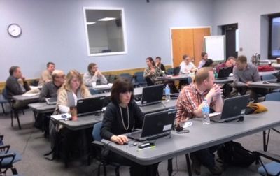
Three separate training sessions on the Coastal Modeling System (CMS) were conducted on 3-6 Feb 2014 for the Buffalo District (LRB), 24-28 Feb 2014 for the Detroit District (LRE), and 7-11 Apr 2014 for the Chicago District (LRC). The training requests were initiated through the Dredging Operations Technical Support (DOTS) program. Dr. Zeki Demirbilek and Dr. Lihwa Lin, from CIRP, conducted training that was customized to the needs of District projects. These special-request trainings were closely coordinated with each District and customized for their specific needs. Modeling grids and inputs were prepared in advance based on review of project requirements and modeling capabilities pertinent to addressing specific needs of each project. Each hands-on training was tailored to each District project, with a focus on the technical features and capabilities of CMS-Wave and CMS-Flow models, as well as the models’ interface in the Surface-water Modeling System (SMS). Test simulations were performed and SMS, Fortran and Matlab tools were used to post-process and utilize modeling results in projects.
POC: (ERDC) Zeki Demirbilek, Zeki.Demirbilek@usace.army.mil
POC: (ERDC) Lihwa Lin, Lihwa.Lin@usace.army.mil
RSM and CIRP Nearshore Berms Working Meeting

The Regional Sediment Management (RSM) Program and Coastal Inlets Research Program (CIRP) teamed up to conduct a working meeting on placement of sediment in the nearshore, with support from the Dredging Operations and Environmental Research (DOER) Program. There were 52 participants from 13 Districts, ERDC-CHL, and ERDC-EL, with 21 participating via webinar. Sediment dredged from navigation channels often has a significant percentage (5-10% or more) of fines, which may be prohibited from direct placement on beaches by state law. Nearshore placement is a low-cost way of keeping sediment in the littoral system, providing a wave break that protects beaches, and allowing nature to sort fines offshore and transport coarser sand towards the beach. Topics discussed included environmental regulations and benefits; methods to determine the fate of berms, whether dispersive, stable, or migratory; guidance needed; existing models and tools that could be applied for calculations in the nearshore; and short- and long-term research needs. ERDC Team: Tanya Beck, Cheryl Pollock, Linda Lillycrop, and Julie Rosati.
POC: (ERDC) Tanya Beck, Tanya.M.Beck@usace.army.mil
Engineer Research & Development Center
3909 Halls Ferry Road, Coastal & Hydraulics Laboratory
Vicksburg, MS 39180
251-635-9519


