File:Step4b.png
Size of this preview: 588 × 600 pixels. Other resolution: 611 × 623 pixels.
Original file (611 × 623 pixels, file size: 211 KB, MIME type: image/png)
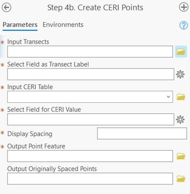
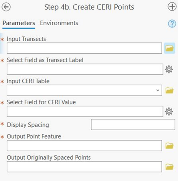
Figure 17. Step 4b: Create CERI Points Geoprocessing Pane. Red asterisks indicate required values.
File history
Click on a date/time to view the file as it appeared at that time.
| Date/Time | Thumbnail | Dimensions | User | Comment | |
|---|---|---|---|---|---|
| current | 17:13, 26 September 2024 | | 611 × 623 (211 KB) | RDCHLSLS (talk | contribs) |
You cannot overwrite this file.
File usage
The following page uses this file: