Salinity Calculations in the Jupiter Inlet - Loxahatchee River System, FL
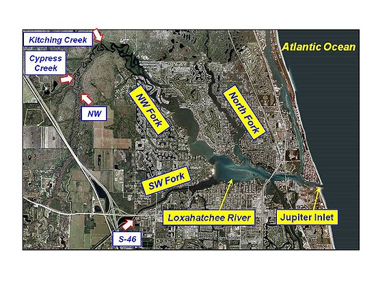
The Loxahatchee River is a 7.6-mile-long river near the southeast coast of Florida. Freshwater meanders through the river’s three main forks, the North Fork, the Northwest Fork and the Southwest Fork, into the brackish estuary and then flows out the Jupiter Inlet into the Atlantic Ocean (Figure 1). The estuary entrance is protected by dual jetties from ocean waves. Momentum transfer, diffusive process and spatial distributions of salinity in the Jupiter Inlet-Loxahatchee River system are dominated by tides, wind, and freshwater inflows.
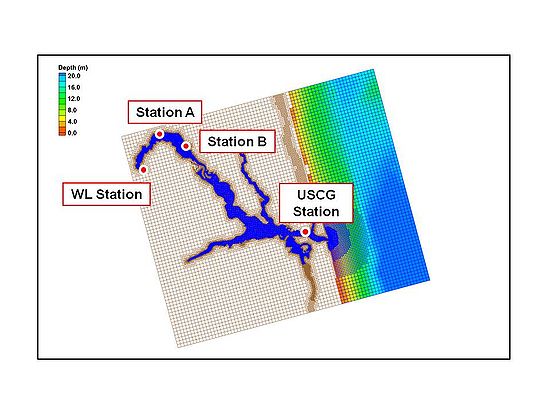
In application of the CMS to the Loxahatchee River, a quadtree grid system was developed to discretize the bay and the offshore. The computational domain extends approximately 11.0 km alongshore and 4.5 km offshore, and the seaward boundary of the domain reaches to the 20 m isobath. Figure 2 shows the quadtree grid with 50,000 ocean cells and bathymetric features of the Jupiter Inlet-Loxahatchee River system, and adjoining nearshore area. The CMS grid permits fine resolution in areas of high interest such as jetties, channels, the bay, and the river. The implicit solver of the CMS with a large time step of 10 minutes was employed for the simulation. Comparing to the explicit solver for a similar model, the computation time was reduced by more than 50%.

