Quick Response Toolbox: Step 8 - Calculate Volume Change Above MHW Shoreline

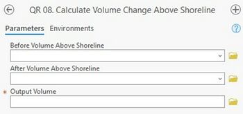
Summary: This tool calculates the difference between before and after volumes above MHW quantified in Step 7
Before Volume Above Shoreline: Output volume from Step 7 for the ‘before’ volume above shoreline.
After Volume Above Shoreline: Output volume from Step 7 for the ‘after’ volume above shoreline.
Output Volume: Feature class where the volume above MHW change will be written. The output file name will be “User-defined project name” + “_date_” + “MHWVolDiff”.
Best Practices & Example Data:
- The shorelines from this tool may require manual editing to delete contour lines that are not shoreline data. For smoothing tolerance, a value of 20 meters is typically effective and is the default value within the tool.
- The tool cannot differentiate between previously created transect mask files and new "clean" runs. The tool also does not overwrite attributes if there is no data present. Therefore, exercise caution if bringing in transect masks or transects from past runs that have data written to them.
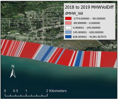
Figure 10 below displays Volume Change Above MHW output for Homer, AK 2019 example data. Symbology is edited to display volume attribute. When the output from this step is loaded into the map the user may wish to alter the symbology. Below the data is symbolized based on the “dMHW_Vol” attribute.
