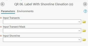
Quick Response Toolbox: Step 6 - Label with Shoreline Elevation
Jump to navigation
Jump to search

Summary: This step adds the “MHW” field name to the transect fields. If the MHW value does not change this step does not need to be re-run for another raster year.
Input Transects: Transects created in Step 1.
Input Transect Mask: Transect Mask created in Step 2.
Input Shoreline: Shoreline feature class created in Step 5.